Conversion in progress ...
Please wait while we generate your PDF
Coastal Virginia Living Guide
Coastal Virginia, often referred to as Hampton Roads, is not a single city. It is a connected region made up of independent cities, waterways, military bases, thriving business beaches, historic districts and suburban communities. Definitions of Hampton Roads sometimes include additional neighboring communities, but this guide focuses on the seven primary Atkinson Realty markets: Virginia Beach, Norfolk, Chesapeake, Suffolk, Portsmouth, Hampton, and Newport News. These cities are geographically close but they offer very different housing, commuting and lifestyle experiences. Water is one of the region’s greatest amenities and one of its most important logistical considerations. Rivers, bays, harbors, bridges and tunnels influence where people live, how they commute and what they should investigate before purchasing a property. Atkinson Realty has served Hampton Roads since 1943 and is Coastal Virginia’s historic real estate authority. That local history gives the us an opportunity to make this guide more useful than a generic relocation article: it should help you compare cities, understand property-level risks and build a practical home-search strategy.
Item Title
Lorem ipsum dolor sit amet, consectetur adipiscing elit. Suspendisse varius enim in eros elementum tristique.
Item Title
Lorem ipsum dolor sit amet, consectetur adipiscing elit. Suspendisse varius enim in eros elementum tristique.
Coastal Virginia At-A-Glance
City Landscape and Living Patterns
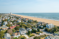
Virginia Beach
A diverse coastal city with Atlantic Ocean beaches, Chesapeake Bay communities, established suburbs, waterfront neighborhoods, an urban Town Center and rural areas in the south. Housing ranges from oceanfront condominiums and waterfront homes to townhomes, planned communities and properties with acreage.
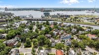
Norfolk
A compact, urban waterfront city known for historic neighborhoods, walkable districts and close proximity to major employers and military bases. Residents can choose from downtown apartments, historic homes, condominiums and established residential communities.
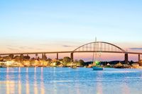
Chesapeake
A geographically large city blending suburban neighborhoods, newer planned communities, farmland, wetlands and semi-rural areas. Housing options include townhomes, single-family subdivisions, waterfront properties and homes on larger lots.
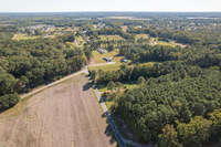
Suffolk
A growing city that combines suburban development with rural landscapes, farmland, lakes and riverfront communities. Residents often choose Suffolk for newer construction, more space and a quieter setting while remaining connected to the larger Hampton Roads region.

Portsmouth
A historic waterfront city with compact neighborhoods, traditional architecture and direct connections to Norfolk across the Elizabeth River. Housing includes historic homes, townhomes, condominiums and established neighborhoods at a wide range of price points.
Hampton
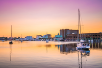
A coastal Peninsula city featuring Chesapeake Bay shoreline, historic districts, military communities and established suburban neighborhoods. Housing ranges from Bayfront and waterfront properties to traditional single-family homes, apartments and townhomes.

Newport News
A long, varied Peninsula city with urban districts, wooded neighborhoods, waterfront areas and major employment centers. Residents can find established suburban communities, historic homes, apartments and properties near the James River and the city’s parks.
City Vibe and Recreation
Virginia Beach
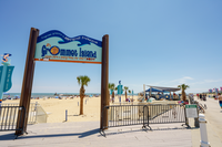
Energetic, coastal and outdoors-oriented. Surfing, boating, fishing, kayaking, boardwalk activities, state parks, wildlife refuges and an active dining and entertainment scene. Youth sports, adult recreation leagues and stunning, well-maintained parks and nature trails spread across the landscape are part of what makes for active and action-packed ifestyles here.
Norfolk
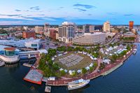
Urban, creative and maritime perfectly defines Norfolk! The city offers waterfront dining, museums like the Chrysler Museum of Art, a rotating myraid of festivals that welcome all at Town Point Park, performing arts, historic districts with wobbly bricks, and Chesapeake Bay beaches in Ocean View and East Beach.
Chesapeake
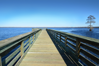
Relaxed, spacious and nature-focused. Recreation centers on trails, waterways, community parks, lots of good fishing, paddling and destinations such as the Great Dismal Swamp and Northwest River Park. Pull up and chair and stay awhile!

Suffolk
Quiet, welcoming and increasingly suburban, with strong rural and waterfront character. Popular activities include boating, fishing, paddling, hiking, visiting local farms and exploring the Nansemond River and surrounding lakes. People come for the quiet life, and stay for thefabulous peanuts.

Portsmouth
Historic, arts-oriented and connected to the working harbor. Residents can explore Olde Towne, walk the waterfront seawall, visit mutiple museums all within a short distance, attend community events or take the Elizabeth River Ferry to Norfolk. Don't forget to visit the weekly farmer's market!
Hampton
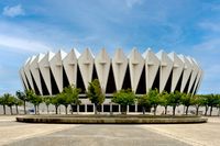
Coastal, historic and military-influenced. Recreation includes Buckroe Beach, Fort Monroe, Grandview Nature Preserve, boating, fishing, waterfront festivals and access to Chesapeake Bay scenery. Shows the Hampton Coliseum are fun for all ages with shopping and, movies, and entertainment nearby.

Newport News
Wooded, active and closely connected to the James River. The city is known for Newport News Park, the Noland Trail, Mariners’ Lake, hiking, cycling, camping, boating, fishing and maritime attractions.
Where to Live in Coastal Virginia
Breaking it down for you, city by city with all the details in between.
Virginia Beach
Virginia Beach offers one of Hampton Roads' broadest ranges of living environments. It includes the resort-oriented Oceanfront, Chesapeake Bay communities, Sandbridge, established suburban areas, Town Center, extensive waterfront neighborhoods and the more rural landscape of southern Virginia Beach, also known as Pungo. For residents who place a high priority on direct beach access, boating or an outdoor lifestyle, Virginia Beach is highly coveted.
Important considerations
Flood exposure can vary block by block, particularly near the Atlantic Ocean, Chesapeake Bay, Lynnhaven River, Rudee Inlet, Back Bay and other tidal waterways. Buyers should also investigate wind coverage, salt-air maintenance, seasonal traffic and local regulations when considering a vacation or short-term-rental use.
NAS Oceana is the Navy’s East Coast Master Jet Base and operates alongside Dam Neck Annex and Naval Auxiliary Landing Field Fentress. Flight activity and aircraft noise are normal parts of life in several portions of Virginia Beach and neighboring Chesapeake, so buyers should visit a prospective property at different times of day and review applicable noise-zone information.
Virginia Beach may belong on the shortlist when the priorities include: direct Atlantic or Chesapeake Bay access, the widest selection of coastal property types, suburban amenities, boating or a Virginia Beach military assignment.
Norfolk
Norfolk provides one of Coastal Virginia’s most urban living experiences. Its waterfront downtown includes restaurants, entertainment, cultural institutions and employment centers, while nearby areas such as Ghent, Freemason, the NEON District and other established neighborhoods offer a mixture of historic architecture, apartments, condominiums and single-family homes. Norfolk’s downtown is a walkable waterfront hub. The city also has a genuine beach district: Ocean View and East Beach that sit along the Chesapeake Bay, and Norfolk maintains three public beach parks in that area.
Norfolk is especially relevant to households connected to Naval Station Norfolk, Naval Support Activity Hampton Roads, downtown employers, hospitals, universities and the maritime economy. Naval Station Norfolk identifies Hampton Roads as the seven-city region covered in this guide.
Important considerations
Many Norfolk properties are older, which can be appealing architecturally but requires careful inspection of roofs, foundations, crawlspaces, electrical systems, plumbing, windows and previous renovations. Flooding and tidal drainage are highly property-specific. Parking availability can also differ significantly between downtown, historic districts and residential areas.
A house that is geographically close to Naval Station Norfolk may not necessarily have the simplest gate commute. Military buyers should test the route during their actual report time rather than relying on mileage alone.
Norfolk may belong on the shortlist when the priorities include: urban amenities, historic architecture, proximity to Naval Station Norfolk, a more compact neighborhood pattern or access to Chesapeake Bay beaches without living in a resort district.
Chesapeake
Chesapeake is a geographically large city with a mixture of suburban communities, established neighborhoods, newer development, farmland, wetlands and semi-rural properties. Its housing inventory includes townhomes, planned subdivisions, homes on larger lots, rural properties and waterfront homes along rivers and tributaries. The city’s outdoor identity is centered more on waterways, forests and wetlands than on traditional oceanfront beaches. The Great Dismal Swamp National Wildlife Refuge covers more than 112,000 acres across Chesapeake, Suffolk and North Carolina. The Dismal Swamp Canal Trail offers approximately 8.6 miles for walking, cycling, running and related activities.
Chesapeake can provide convenient access to portions of Norfolk, Virginia Beach, Portsmouth and North Carolina, but commute results vary widely depending on the neighborhood and employment location. A home in northern Chesapeake can function very differently from one in the southern or western part of the city.
Important considerations
For outlying properties, buyers should determine whether the home has municipal water and sewer or private well and septic service. Other questions may include internet availability, road maintenance, drainage, wetlands, flood exposure, agricultural activity and the maintenance needs associated with a larger parcel.
The Census Bureau reports a 74.4% owner-occupancy rate for Chesapeake during the 2020–2024 period, along with one of the higher median household incomes among the seven cities.
Chesapeake may belong on the shortlist when the priorities include: suburban housing, larger lots, newer communities, access to natural areas or a location between several Southside employment centers.
Suffolk
Suffolk combines growing suburban communities with a substantial rural landscape. Buyers can find planned developments, traditional neighborhoods, downtown properties, farmland, lakefront settings and homes along the Nansemond River and other waterways. Suffolk boasts more than 8,000 acres of lakes and miles of river shoreline. This gives the city a strong boating, paddling, fishing and nature-oriented identity, even though it does not have a conventional Atlantic Ocean resort-style beach.
But, Suffolk has been growing! Census estimates indicate its population increased by 10.9% between the April 2020 estimate base and July 2025.
Important considerations
Suffolk’s size means the home-to-work route should be investigated before choosing a neighborhood. Census data place its 2020–2024 mean commute at approximately 30.2 minutes, the longest of the seven city averages in this comparison. An individual commute may be much shorter or substantially longer.
Rural and waterfront buyers should verify water and sewer service, septic capacity, internet availability, private-road obligations, flood exposure, dock or bulkhead condition and travel time to everyday services.
Suffolk may belong on the shortlist when the priorities include: newer suburban construction, more land, lower-density surroundings, river or lake access, or a western Southside location.
Portsmouth
Portsmouth sits along the Elizabeth River directly across from Norfolk. Its identity is closely connected to Olde Towne, historic architecture, the working harbor, the waterfront and the Norfolk Naval Shipyard.
Olde Towne offers a compact historic district with access to restaurants, museums, cultural attractions and the waterfront. The Portsmouth Seawall follows the Elizabeth River and Craford Bay, while Hampton Roads Transit’s Elizabeth River Ferry connects portions of Portsmouth and Norfolk.
The city’s housing includes historic homes, modest single-family properties, townhomes, condominiums and waterfront residences. Census estimates show a lower median owner-occupied home value and gross rent than several neighboring cities, although property condition and location create considerable variation.
Important considerations
Older properties may require more extensive inspection and renovation planning. Flood exposure, crawlspace condition, previous moisture intrusion, historic-district requirements and insurance availability should be evaluated early.
Portsmouth-to-Norfolk and Portsmouth-to-Virginia Beach trips can involve the Downtown or Midtown tunnels. These crossings have tolls, and traffic conditions can affect the practical cost and length of a commute.
Portsmouth may belong on the shortlist when the priorities include: historic character, an Elizabeth River setting, access to the Norfolk Naval Shipyard, ferry connectivity or a lower citywide housing-cost baseline.
Hampton
Hampton is located on the Virginia Peninsula and combines Chesapeake Bay beaches, historic sites, established neighborhoods, military employment and access to the Hampton Roads Bridge-Tunnel.
Its beach options include Buckroe Beach, Grandview Nature Preserve and Outlook Beach at Fort Monroe. Buckroe provides a traditional public beach experience with a boardwalk and seasonal amenities, while Grandview is a more natural setting with salt marsh, tidal creeks and Chesapeake Bay shoreline.
Hampton is closely associated with Langley Air Force Base. Langley forms part of Joint Base Langley-Eustis, with Fort Eustis located in neighboring Newport News.
Important considerations
Hampton can be convenient for Peninsula employment, Langley and portions of Newport News. A routine commute to Norfolk or Virginia Beach, however, may require the Hampton Roads Bridge-Tunnel. The HRBT carries substantial daily traffic, making route testing essential for anyone working on the Southside.
Bayfront and low-lying properties should be evaluated for flood exposure, drainage, wind coverage and salt-air maintenance. Aircraft activity may also be noticeable in areas around Langley.
Hampton may belong on the shortlist when the priorities include: Chesapeake Bay access, proximity to Langley, Peninsula employment, historic Fort Monroe or a housing-cost baseline below Virginia Beach and Chesapeake.
Newport News
Newport News stretches along the Virginia Peninsula and includes urban districts, established suburban neighborhoods, wooded residential areas, waterfront locations and major employment centers. It is home to Fort Eustis and has a strong relationship with shipbuilding, maritime history and the James River.
Outdoor recreation is a major part of the city’s appeal. Newport News Parks and Recreation oversees 36 public parks and approximately 50 miles of trails. The five-mile Noland Trail surrounds Mariners’ Lake, and Newport News Park provides extensive woods, trails, reservoirs, camping, boating and fishing.
Huntington Park also provides a public beach setting near the James River Bridge, although it is a river beach rather than an Atlantic resort beach.
Fort Eustis is located in Newport News and has long supported Army transportation training, research and operations.
Important considerations
Newport News can work particularly well for employment on the Peninsula. Commuting to Norfolk or Virginia Beach generally means using the HRBT or Monitor-Merrimac Memorial Bridge-Tunnel, so the practical commute should be evaluated before choosing a home. The MMMBT connects the Peninsula to Suffolk and Chesapeake and often serves as an alternative to the HRBT.
Housing age, condition and neighborhood form vary significantly throughout the city, making property-level inspection and location analysis especially important.
Newport News may belong on the shortlist when the priorities include: Fort Eustis, Peninsula employment, parks and trails, James River access or a broad range of housing price points.
Understanding Flood Zones
Flood risk is one of the most important parts of buying property in Coastal Virginia, but a flood-zone designation should be treated as the beginning of the investigation—not the entire answer. The FEMA Flood Map Service Center is the official location for current federal flood-hazard mapping products. Flood maps help lenders evaluate insurance requirements and help communities manage flood risk.
Common flood terms
FIRM
A Flood Insurance Rate Map, the official community map showing mapped flood-hazard areas and flood zones
Zone AE
A mapped 1%-annual-chance flood area where a Base Flood Elevation is provided
Zone X
An area outside the mapped Special Flood Hazard Area or shown as having lower mapped risk; it does not mean zero risk
SFHA
Special Flood Hazard Area, generally the mapped area subject to a 1% or greater annual chance of flooding
Zone VE
A coastal high-hazard area subject to the base flood and additional wave action or fast-moving water
BFE
Base Flood Elevation, the projected water-surface elevation associated with the 1%-annual-chance flood
Flood Due Dilligence Checklist
A “1% annual chance” does not mean flooding happens once every 100 years. Mathematically, repeated 1% annual exposure equates to roughly a 26% chance over 30 years.
FEMA defines the Base Flood Elevation as the water-surface elevation from a flood that has a 1% chance of being equaled or exceeded in any given year. FEMA identifies Zone VE as a coastal high-hazard area where waves and fast-moving water can cause additional damage.
Before purchasing, buyers should:
- Look up the exact address on the FEMA map.
- Review any city flood or stormwater mapping available for the property.
- Determine the property’s elevation relative to the Base Flood Elevation.
- Request an elevation certificate when one exists or may be useful.
- Ask about prior water intrusion, flood claims, drainage work and repairs.
- Inspect the crawlspace, foundation, lower-level mechanical systems and grading.
- Obtain an actual flood-insurance quote for the address.
- Ask whether the lender will require flood coverage.
- Review evacuation-zone information separately from the FEMA insurance zone.
- Consider heavy-rain and tidal-drainage risk even when the property is outside a high-risk mapped zone.
(link out to FEMA map)